


Underground Mapping
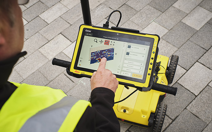
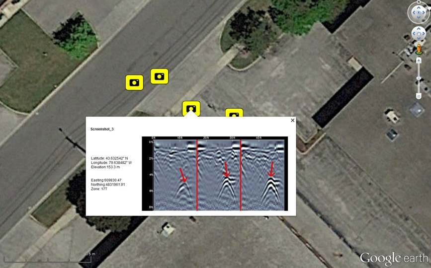
Our expertise in GPR technology allows us to reveal the hidden depths beneath the Earth's surface, providing invaluable insights for a wide range of industries. With our advanced GPR services, we offer accurate and non-destructive imaging of subsurface structures, utilities, and geological features. By utilizing electromagnetic waves, our GPR equipment can penetrate the ground, detecting variations in material composition and creating detailed 2D and 3D maps of underground environments.
The applications of our GPR services are diverse and essential for industries such as construction, utilities, environmental assessment, and infrastructure development. GPR enables precise mapping of underground utilities, including pipes, cables, and conduits, ensuring efficient excavation and avoiding costly damage to critical infrastructure.

Our GPR technology also plays a crucial role in geotechnical investigations, allowing for the identification of underground features such as bedrock, voids, and soil layering. This information aids in site characterization, foundation design, and overall project planning, ensuring safe and cost-effective construction practices.
GIZIL recognizes the significance of GPR technology in the context of digital twin projects. By accurately mapping the underground environment, our GPR services contribute to the development of comprehensive digital twins that encompass both the visible and hidden elements of assets.
Digital twins enriched with GPR data provide a holistic representation of infrastructure and utilities, enabling real-time monitoring, asset management, and predictive maintenance. The integration of underground mapping data into digital twins enhances their accuracy, reliability, and effectiveness, empowering asset-intensive sectors to make informed decisions and optimize operational performance.
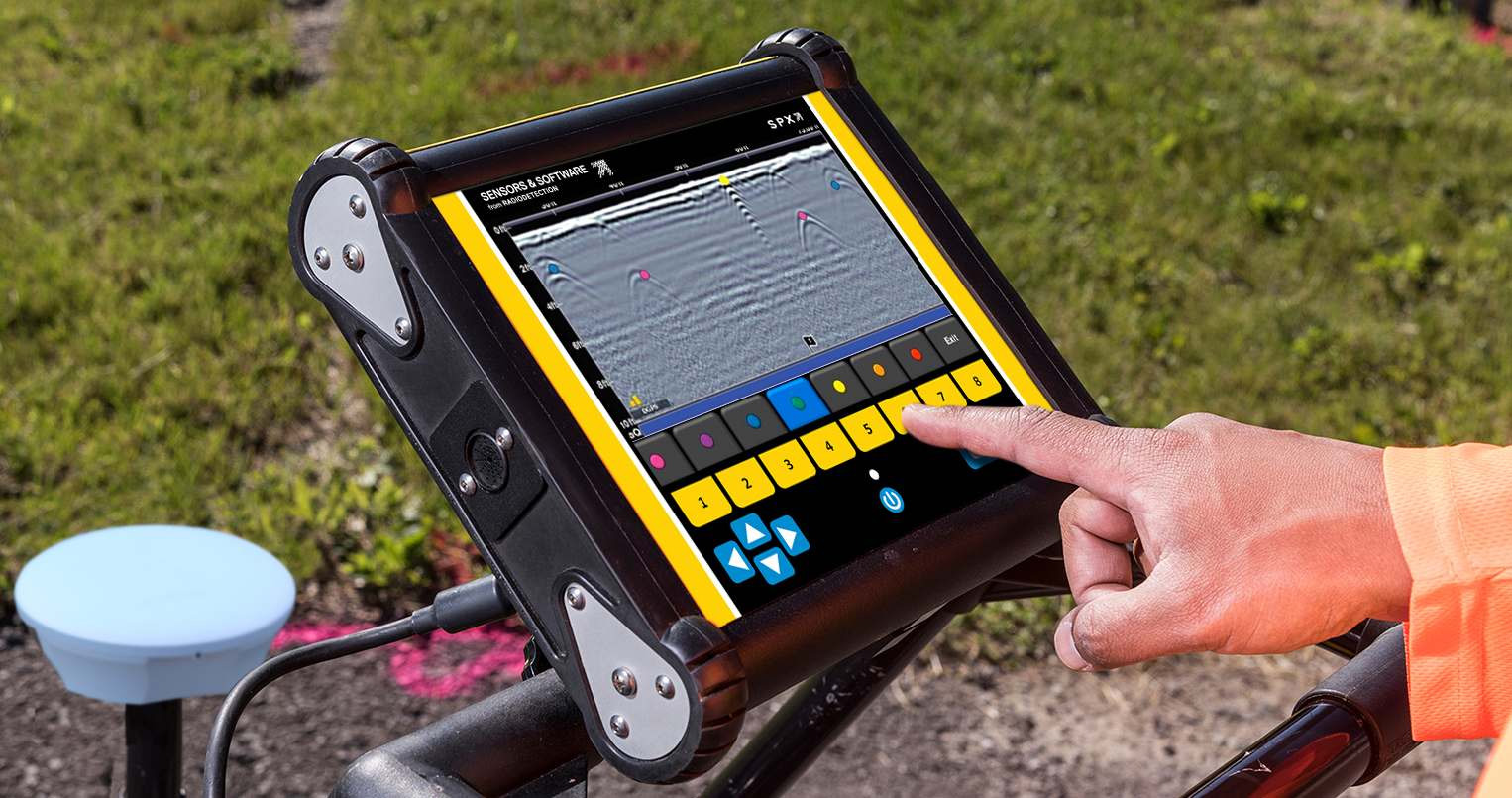
Our commitment to innovation and advanced equipment ensures that we deliver exceptional underground mapping results. Virtual Plant Technologies maintains a state-of-the-art GPR portfolio, comprising high-frequency antennas, multi-channel systems, and advanced data processing software. This enables us to capture detailed subsurface information with outstanding resolution, depth penetration, and data quality.
With GIZIL as your trusted partner, you can rely on our experienced team of GPR specialists who understand the unique challenges of underground mapping projects. We collaborate closely with our clients, tailoring our services to their specific needs and ensuring that the acquired data is accurate, actionable, and aligned with project objectives.
Experience the power of Virtual Plant Technologies' Ground Penetrating Radar services and unlock the hidden depths beneath your feet. Visit our webpage to learn more about our GPR solutions and discover how we can revolutionize your underground mapping endeavors.