


We believe in digitalization's potential. It's a game-changer, connecting people worldwide, giving individualized goods and experiences, and bringing a degree of comfort and convenience that was impossible only a few years ago. Our passion is to add value via new ideas and technology. We are the market's innovative force of digital transformation, combining digital experience, industrial know-how, and software development capabilities. We are trying our best to learn more about our target audience. We anticipate what people want to maintain their allegiance in the future.
Digital Twin & IoT
Digital twins are already gaining traction in heavy sectors such as oil, gas, and power. These industries want to transition from periodic to condition-based maintenance. This is an area where prices might be drastically lowered by up to 30% in many cases. The same technology may provide a safer working environment for crew members performing maintenance on the sites.
Learn More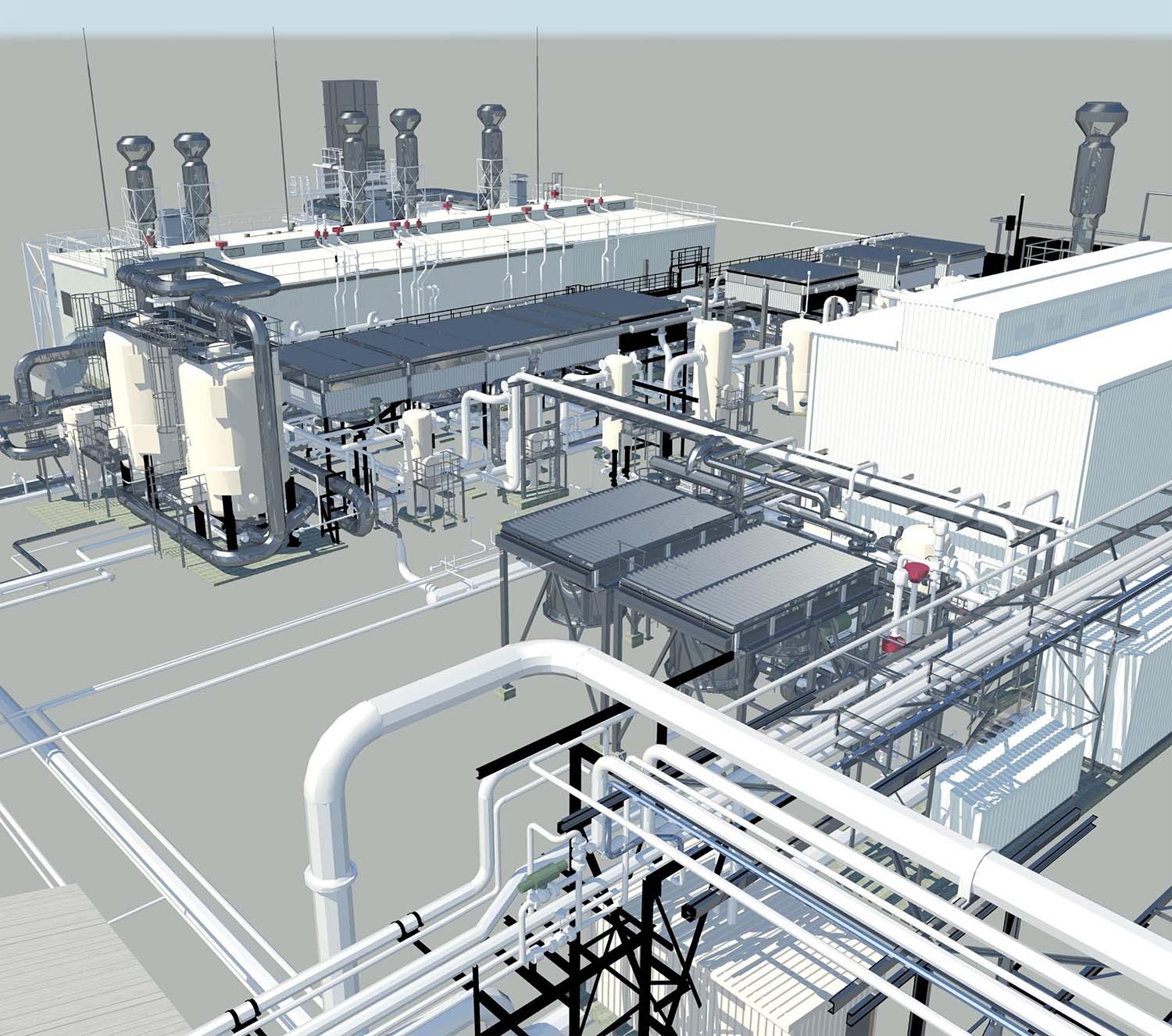
Digital Asset Management
When paired with data-driven insights, new digital technologies have the potential to alter operations, increasing agility and strategic decision-making. The capacity to capture and evaluate data, then take appropriate action while reducing hazards to personnel and the environment is essential to how the sector runs. This approach to operations is made feasible by using technology and critical physical infrastructures, such as sensors and automation, throughout the business's upstream, midstream, and downstream segments.
Learn More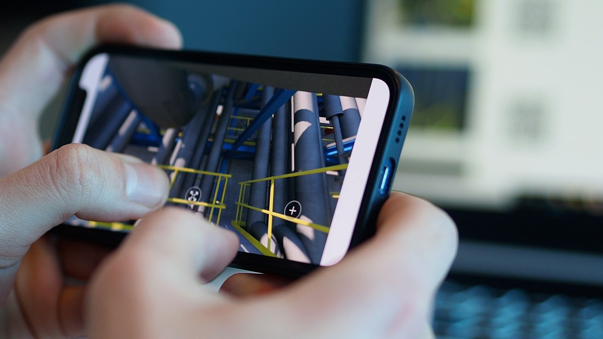
BIM
Building Information Modeling (BIM) has been used effectively by GIZIL to process information in virtual models in integrated planning, construction, and associated building services. In our planning, we generate a precise 3D model of a construction project – and then expand it into the 4-dimension, "schedule," and finally the fifth dimension, "budget," as the construction process progresses. This is how we utilize 5D BIM to shape the construction project's desired value chain throughout all project phases. Before beginning building on-site, we inspect the 3D model for any interferences. This is critical during the building process. Our clash detection services can identify any complex, soft, or process clash, saving you money, time, and resources.
Learn More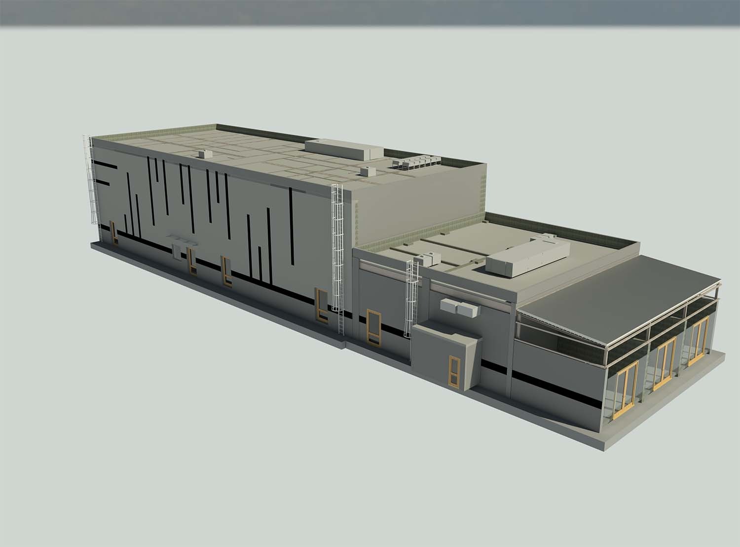
3D Inspection and Dimensional Control Surveys
GIZIL's Dimensional Control and Monitoring services, which employ tried-and-true engineering survey procedures and cutting-edge survey technology, may add significant value to any project. Dimensional Control collects exact as-built 3D data on new or existing mechanical, structural, and civil engineering projects using proven engineering survey procedures and high technology survey equipment. This carefully obtained spatial data, like laser scanning, is employed throughout project planning and execution to eliminate uncertainty linked to interface integration and measurement abnormalities.
Learn More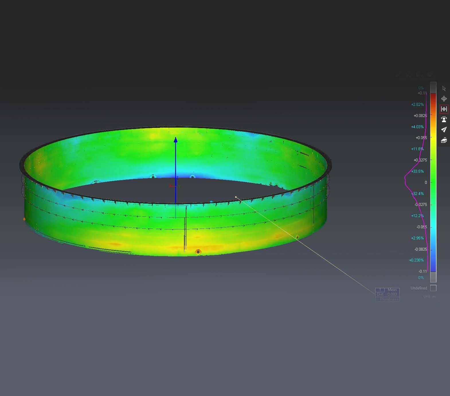
Software Development and Gamification
Recent innovations in augmented and virtual reality (VR) solutions and employee-generated solutions are used in project execution. In the video game, engineering, and construction sectors, virtual and augmented reality are increasingly frequently employed. These technologies give employees a lifelike experience; these same immersive experiences aid the engineering and construction industries. Using VR, plant design models and 3D site scans may be turned into virtual tour settings. Project teams and operational corporations can tour buildings without breaking ground or leaving their workstations.
Learn More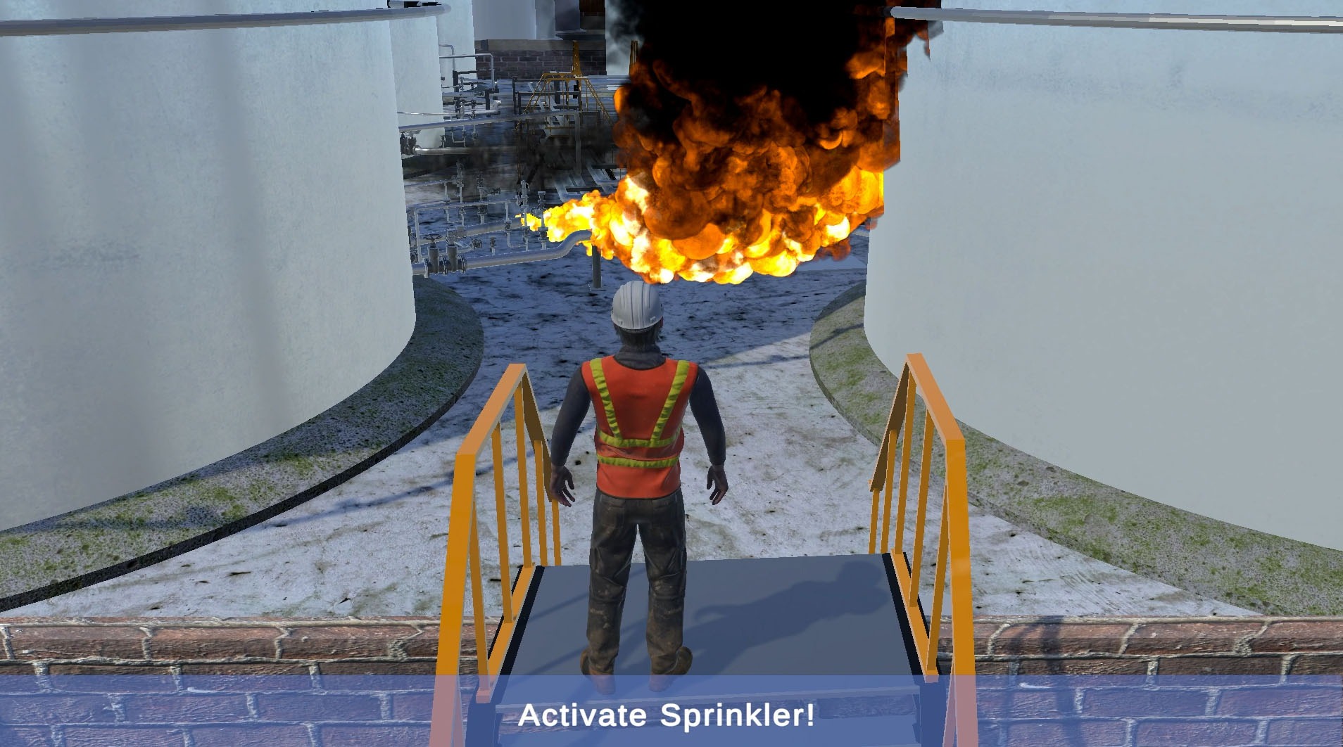
3D City Infrastructure and Smart Cities
Remote sensing, reality capture, and surveying applications generate massive datasets containing points, vectors, orthophotos, 3D models, etc. This data may be combined and connected with metadata to create a city-scale application that generates 3D city infrastructure and smart cities. The growth of autonomous cars and the internet of things will soon enhance the need for 3D smart cities.
Learn More
GIS - Geographic Information System
A geographic information system (GIS) is a computer system that generates, maintains, analyzes, and maps various types of data. GIS connects data to a map by combining location data with other forms of descriptive information. This lays the groundwork for mapping and analysis employed in research and practically every sector.
Learn More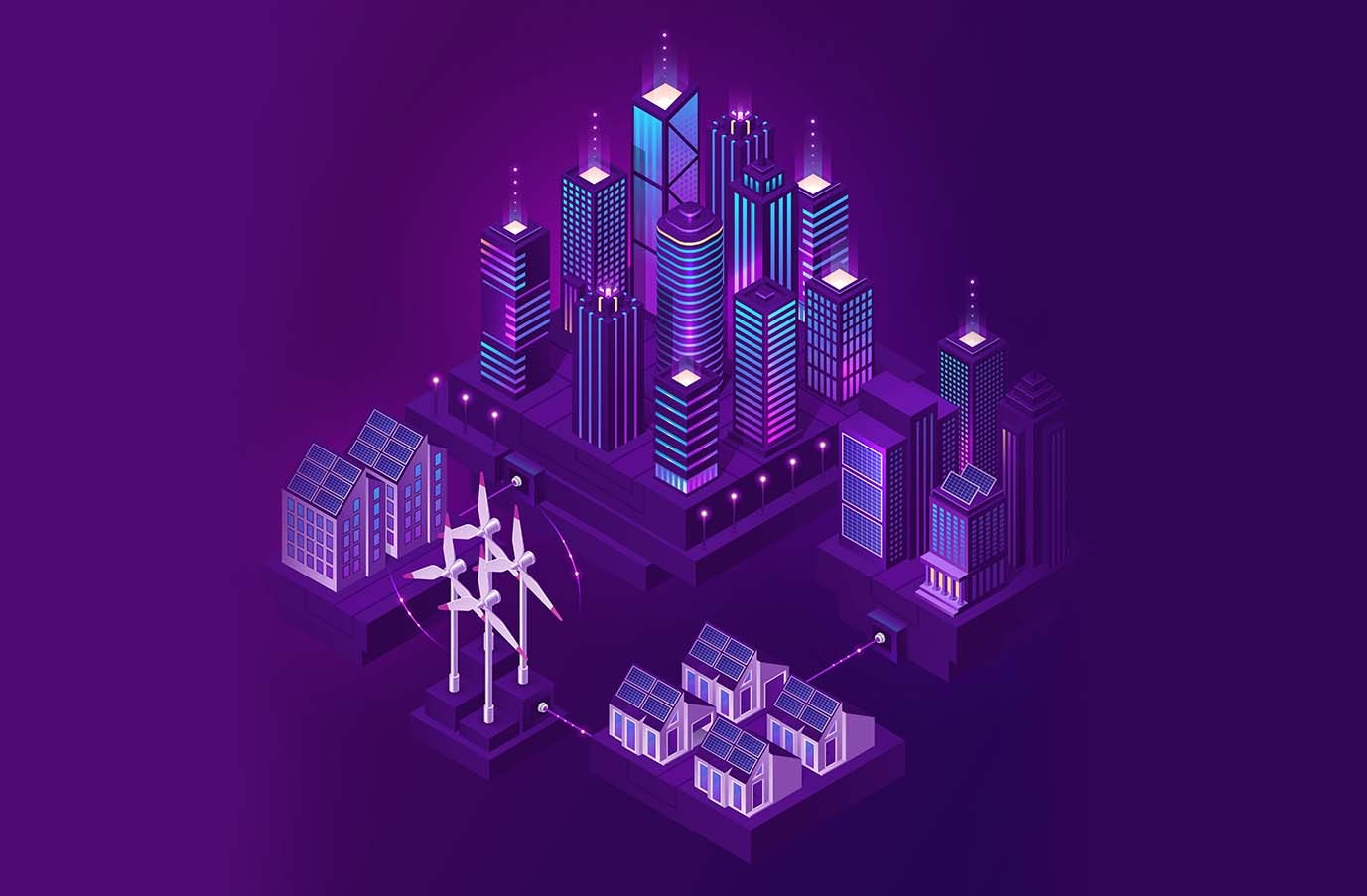

GIZIL is a leading provider of next-generation software and digital solutions to customers in the process industries. Digital, together with the rest of GIZIL, provides solutions in reality capture, intelligent modeling, intelligent data, virtual/augmented reality, and other fields.